
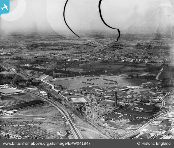
EPW041847 ENGLAND (1933). The Horse Ring football ground and various factories, Park Royal, from the south-east, 1933. This image has been produced from a damaged negative.
© Copyright OpenStreetMap contributors and licensed by the OpenStreetMap Foundation. 2026. Cartography is licensed as CC BY-SA.
Nearby Images (42)
EPW041847

EAW017054

EPW033754

EAW017055

EAW017051

EPW033804

EAW017053

EPW033752

EPW033753

EAW017048

EAW017050

EPW033748

EPW033808

EPW055631

EPW033810

EPW055632

EPW033806

EPW033747

EAW017047

EPW033805

EAW017046

EPW033751

EAW017049

EPW033809

EPW055633

EPW033750

EPW033749

EPW033807

EAW017052

EPW055630

EPW033746

EPW041846

EPW041853

EPW041858

EPW048435

EPW041860

EPW041850

EAW031549

EPW041852

EPW041857

EAW031552

EPW041851

Details
| Title | [EPW041847] The Horse Ring football ground and various factories, Park Royal, from the south-east, 1933. This image has been produced from a damaged negative. |
| Reference | EPW041847 |
| Date | June-1933 |
| Link | |
| Place name | PARK ROYAL |
| Parish | |
| District | |
| Country | ENGLAND |
| Easting / Northing | 519597, 182565 |
| Longitude / Latitude | -0.27570438293961, 51.528832978816 |
| National Grid Reference | TQ196826 |
Pins

Leslie B |
Tuesday 11th of May 2021 03:01:28 PM | |
|
gBr |
Thursday 26th of January 2017 09:24:59 PM | |
|
gBr |
Thursday 26th of January 2017 09:21:59 PM | |
|
gBr |
Thursday 26th of January 2017 09:18:28 PM | |

Class31 |
Wednesday 19th of August 2015 11:38:49 AM | |
|
Class31 |
Wednesday 19th of August 2015 09:23:42 AM |