
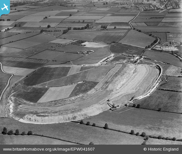
EPW041607 ENGLAND (1933). The Hawton Gypsum Quarry alongside Bowbridge Lane, Hawton, 1933
© Copyright OpenStreetMap contributors and licensed by the OpenStreetMap Foundation. 2026. Cartography is licensed as CC BY-SA.
Nearby Images (7)
EPW041607

EPW041606

EPW041608

EPW041611

EPW041612

EPW041609

EPW041605

Details
| Title | [EPW041607] The Hawton Gypsum Quarry alongside Bowbridge Lane, Hawton, 1933 |
| Reference | EPW041607 |
| Date | June-1933 |
| Link | |
| Place name | HAWTON |
| Parish | HAWTON |
| District | |
| Country | ENGLAND |
| Easting / Northing | 479856, 350468 |
| Longitude / Latitude | -0.80869667705196, 53.045204492277 |
| National Grid Reference | SK799505 |
