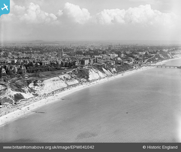
EPW041042 ENGLAND (1933). The seafront, West Cliff Promenade and the town, Bournemouth, from the south, 1933
© Copyright OpenStreetMap contributors and licensed by the OpenStreetMap Foundation. 2026. Cartography is licensed as CC BY-SA.
Details
| Title | [EPW041042] The seafront, West Cliff Promenade and the town, Bournemouth, from the south, 1933 |
| Reference | EPW041042 |
| Date | April-1933 |
| Link | |
| Place name | BOURNEMOUTH |
| Parish | |
| District | |
| Country | ENGLAND |
| Easting / Northing | 408295, 90410 |
| Longitude / Latitude | -1.8824992516423, 50.712688056352 |
| National Grid Reference | SZ083904 |


![[EPW041042] The seafront, West Cliff Promenade and the town, Bournemouth, from the south, 1933](http://britainfromabove.org.uk/sites/all/libraries/aerofilms-images/public/100x100/EPW/041/EPW041042.jpg)
![[EPW013564] West Cliff Promenade, West Cliff, 1925](http://britainfromabove.org.uk/sites/all/libraries/aerofilms-images/public/100x100/EPW/013/EPW013564.jpg)
![[EPW000263] Durley Chine, Bournemouth, from the south-west, 1920](http://britainfromabove.org.uk/sites/all/libraries/aerofilms-images/public/100x100/EPW/000/EPW000263.jpg)

