
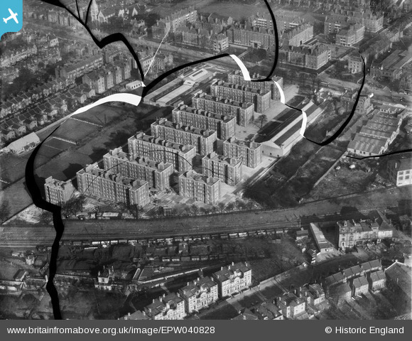
EPW040828 ENGLAND (1933). The Guinness Trust Estate, Stamford Hill, 1933. This image has been produced from a damaged negative.
© Copyright OpenStreetMap contributors and licensed by the OpenStreetMap Foundation. 2026. Cartography is licensed as CC BY-SA.
Nearby Images (5)
EPW040828

EPW040829

EPW040832

EPW040831

EPW040833

Details
| Title | [EPW040828] The Guinness Trust Estate, Stamford Hill, 1933. This image has been produced from a damaged negative. |
| Reference | EPW040828 |
| Date | February-1933 |
| Link | |
| Place name | STAMFORD HILL |
| Parish | |
| District | |
| Country | ENGLAND |
| Easting / Northing | 533471, 187197 |
| Longitude / Latitude | -0.074032908958825, 51.5673529915 |
| National Grid Reference | TQ335872 |
Pins

Jeremy |
Friday 4th of October 2013 04:36:42 PM |