
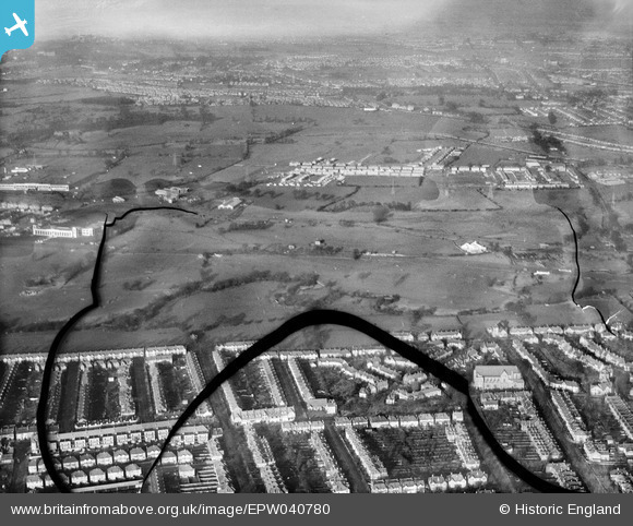
EPW040780 ENGLAND (1932). Housing along Meadvale Road, St Barnabas' Church and Pitshanger Park, Perivale, from the south, 1932. This image has been produced from a damaged negative.
© Copyright OpenStreetMap contributors and licensed by the OpenStreetMap Foundation. 2026. Cartography is licensed as CC BY-SA.
Nearby Images (6)
EPW040780

EPW040782

EPW040783

EPW040784

EPW010020

EPW010017

Details
| Title | [EPW040780] Housing along Meadvale Road, St Barnabas' Church and Pitshanger Park, Perivale, from the south, 1932. This image has been produced from a damaged negative. |
| Reference | EPW040780 |
| Date | December-1932 |
| Link | |
| Place name | PERIVALE |
| Parish | |
| District | |
| Country | ENGLAND |
| Easting / Northing | 517164, 182404 |
| Longitude / Latitude | -0.31081927594038, 51.527896006789 |
| National Grid Reference | TQ172824 |

