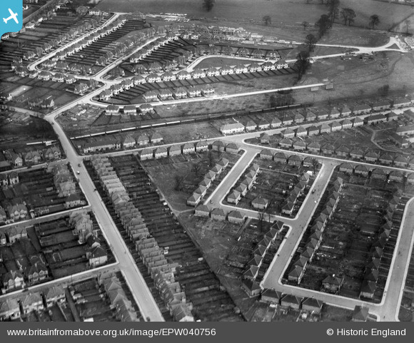
EPW040756 ENGLAND (1932). A new housing estate and houses under construction, Norbiton, 1932
© Copyright OpenStreetMap contributors and licensed by the OpenStreetMap Foundation. 2026. Cartography is licensed as CC BY-SA.
Details
| Title | [EPW040756] A new housing estate and houses under construction, Norbiton, 1932 |
| Reference | EPW040756 |
| Date | October-1932 |
| Link | |
| Place name | NORBITON |
| Parish | |
| District | |
| Country | ENGLAND |
| Easting / Northing | 519657, 169212 |
| Longitude / Latitude | -0.27936157357236, 51.408797016932 |
| National Grid Reference | TQ197692 |
Pins

Maurice |
Wednesday 10th of September 2014 12:39:38 PM | |

Maurice |
Wednesday 10th of September 2014 06:47:07 AM |


![[EPW040756] A new housing estate and houses under construction, Norbiton, 1932](http://britainfromabove.org.uk/sites/all/libraries/aerofilms-images/public/100x100/EPW/040/EPW040756.jpg)
![[EPW040759] A new housing estate under construction, Norbiton, 1932](http://britainfromabove.org.uk/sites/all/libraries/aerofilms-images/public/100x100/EPW/040/EPW040759.jpg)
![[EPW040758] A new housing estate under construction, Norbiton, 1932](http://britainfromabove.org.uk/sites/all/libraries/aerofilms-images/public/100x100/EPW/040/EPW040758.jpg)