
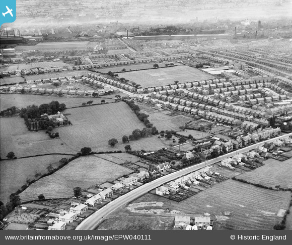
EPW040111 ENGLAND (1932). Nantwich Road and the Ruskin Park Estate, Crewe, 1932
© Copyright OpenStreetMap contributors and licensed by the OpenStreetMap Foundation. 2026. Cartography is licensed as CC BY-SA.
Nearby Images (4)
EPW040111

EPW040112

EPW040109

EPW040113

Details
| Title | [EPW040111] Nantwich Road and the Ruskin Park Estate, Crewe, 1932 |
| Reference | EPW040111 |
| Date | September-1932 |
| Link | |
| Place name | CREWE |
| Parish | |
| District | |
| Country | ENGLAND |
| Easting / Northing | 369811, 354594 |
| Longitude / Latitude | -2.4507966114536, 53.087408569956 |
| National Grid Reference | SJ698546 |
Pins

mollymeg |
Wednesday 13th of January 2021 02:33:02 PM |