
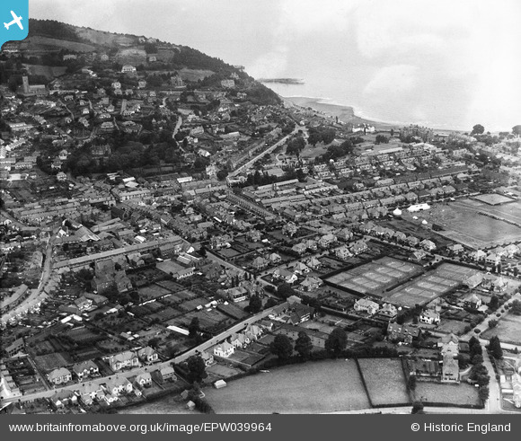
EPW039964 ENGLAND (1932). The town centre, Minehead, 1932
© Copyright OpenStreetMap contributors and licensed by the OpenStreetMap Foundation. 2026. Cartography is licensed as CC BY-SA.
Nearby Images (4)
EPW039964

EPW039963

EAW015030

EPW033296

Details
| Title | [EPW039964] The town centre, Minehead, 1932 |
| Reference | EPW039964 |
| Date | August-1932 |
| Link | |
| Place name | MINEHEAD |
| Parish | MINEHEAD |
| District | |
| Country | ENGLAND |
| Easting / Northing | 296947, 146134 |
| Longitude / Latitude | -3.4753006986286, 51.204591676017 |
| National Grid Reference | SS969461 |
Pins

Toby Clempson |
Wednesday 18th of December 2013 01:58:14 PM | |
|
Toby Clempson |
Wednesday 18th of December 2013 01:57:33 PM | |
|
Toby Clempson |
Wednesday 18th of December 2013 01:53:39 PM | |
|
Toby Clempson |
Wednesday 18th of December 2013 01:51:32 PM | |
An armoury was established there in 1914 and the building burnt down in 1938. |
Lynda Tubbs |
Thursday 13th of February 2014 10:27:55 AM |