
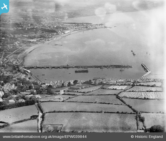
EPW039844 ENGLAND (1932). Newlyn Harbour North Pier and surrounding coastline, Newlyn, 1932
© Copyright OpenStreetMap contributors and licensed by the OpenStreetMap Foundation. 2026. Cartography is licensed as CC BY-SA.
Nearby Images (2)
EPW039844

EPW039842

Details
| Title | [EPW039844] Newlyn Harbour North Pier and surrounding coastline, Newlyn, 1932 |
| Reference | EPW039844 |
| Date | August-1932 |
| Link | |
| Place name | NEWLYN |
| Parish | PENZANCE |
| District | |
| Country | ENGLAND |
| Easting / Northing | 146551, 28732 |
| Longitude / Latitude | -5.5448579963331, 50.103870029552 |
| National Grid Reference | SW466287 |
