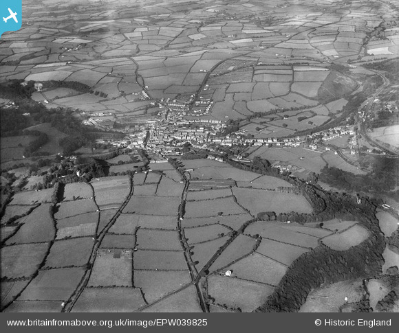
EPW039825 ENGLAND (1932). The town and surrounding countryside, Okehampton, 1932
© Copyright OpenStreetMap contributors and licensed by the OpenStreetMap Foundation. 2026. Cartography is licensed as CC BY-SA.
Details
| Title | [EPW039825] The town and surrounding countryside, Okehampton, 1932 |
| Reference | EPW039825 |
| Date | August-1932 |
| Link | |
| Place name | OKEHAMPTON |
| Parish | OKEHAMPTON |
| District | |
| Country | ENGLAND |
| Easting / Northing | 258535, 94862 |
| Longitude / Latitude | -4.0049431370736, 50.73554915061 |
| National Grid Reference | SX585949 |
Pins

Charles Dale |
Sunday 7th of June 2015 09:49:02 PM | |

emcoag |
Thursday 1st of May 2014 03:46:14 PM | |

Nemetostatio |
Monday 14th of April 2014 11:45:05 PM | |

Nemetostatio |
Monday 14th of April 2014 11:43:33 PM | |

Nemetostatio |
Monday 14th of April 2014 11:33:05 PM | |

keith |
Sunday 5th of May 2013 10:04:30 AM | |

keith |
Sunday 5th of May 2013 10:03:50 AM | |

keith |
Sunday 5th of May 2013 10:02:38 AM | |

keith |
Sunday 5th of May 2013 10:02:16 AM | |

keith |
Sunday 5th of May 2013 10:01:34 AM |


![[EPW039825] The town and surrounding countryside, Okehampton, 1932](http://britainfromabove.org.uk/sites/all/libraries/aerofilms-images/public/100x100/EPW/039/EPW039825.jpg)
![[EPW039827] The town and surrounding countryside, Okehampton, 1932](http://britainfromabove.org.uk/sites/all/libraries/aerofilms-images/public/100x100/EPW/039/EPW039827.jpg)