
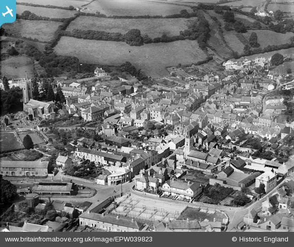
EPW039823 ENGLAND (1932). St Lawrence's Chapel Grammar School, St Andrew's Church and the town centre, Ashburton, 1932
© Copyright OpenStreetMap contributors and licensed by the OpenStreetMap Foundation. 2026. Cartography is licensed as CC BY-SA.
Nearby Images (5)
EPW039823

EPW033030

EPW033028

EPW039822

EPW039821

Details
| Title | [EPW039823] St Lawrence's Chapel Grammar School, St Andrew's Church and the town centre, Ashburton, 1932 |
| Reference | EPW039823 |
| Date | August-1932 |
| Link | |
| Place name | ASHBURTON |
| Parish | ASHBURTON |
| District | |
| Country | ENGLAND |
| Easting / Northing | 275587, 69852 |
| Longitude / Latitude | -3.7550083640236, 50.514623089908 |
| National Grid Reference | SX756699 |
Pins

Gasometerman |
Sunday 9th of August 2020 06:00:03 PM | |

clippedwings |
Sunday 15th of December 2013 10:00:32 PM | |
|
clippedwings |
Sunday 15th of December 2013 09:56:27 PM |