
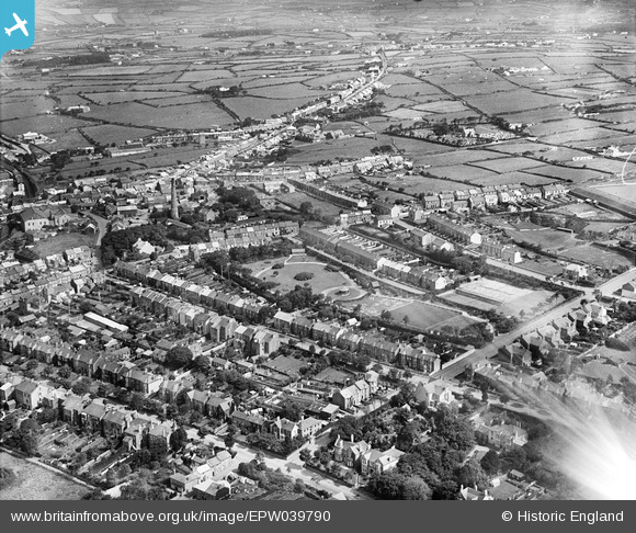
EPW039790 ENGLAND (1932). Victoria Park and the town, Redruth, 1932. This image has been affected by flare.
© Copyright OpenStreetMap contributors and licensed by the OpenStreetMap Foundation. 2026. Cartography is licensed as CC BY-SA.
Nearby Images (3)
EPW039790

EPW039787

EPW009901

Details
| Title | [EPW039790] Victoria Park and the town, Redruth, 1932. This image has been affected by flare. |
| Reference | EPW039790 |
| Date | August-1932 |
| Link | |
| Place name | REDRUTH |
| Parish | REDRUTH |
| District | |
| Country | ENGLAND |
| Easting / Northing | 170293, 41868 |
| Longitude / Latitude | -5.2213024371971, 50.231493856101 |
| National Grid Reference | SW703419 |
Pins
Be the first to add a comment to this image!