
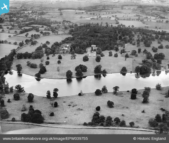
EPW039755 ENGLAND (1932). Redgrave Hall and Park, Redgrave, 1932
© Copyright OpenStreetMap contributors and licensed by the OpenStreetMap Foundation. 2026. Cartography is licensed as CC BY-SA.
Nearby Images (2)
EPW039755

EPW039754

Details
| Title | [EPW039755] Redgrave Hall and Park, Redgrave, 1932 |
| Reference | EPW039755 |
| Date | August-1932 |
| Link | |
| Place name | REDGRAVE |
| Parish | REDGRAVE |
| District | |
| Country | ENGLAND |
| Easting / Northing | 605397, 276769 |
| Longitude / Latitude | 1.0161421154359, 52.350066131281 |
| National Grid Reference | TM054768 |
Pins
Be the first to add a comment to this image!
User Comment Contributions

Demolished 1947 |

Where's Canning Town? |
Wednesday 12th of February 2014 08:17:22 PM |
'Modernised' in the 1760s at the same time as Capability Brown redesigned the parkland. Demolished in 1947. All that remains now is the Round House and kennels. |
Where's Canning Town? |
Wednesday 12th of February 2014 08:10:35 PM |