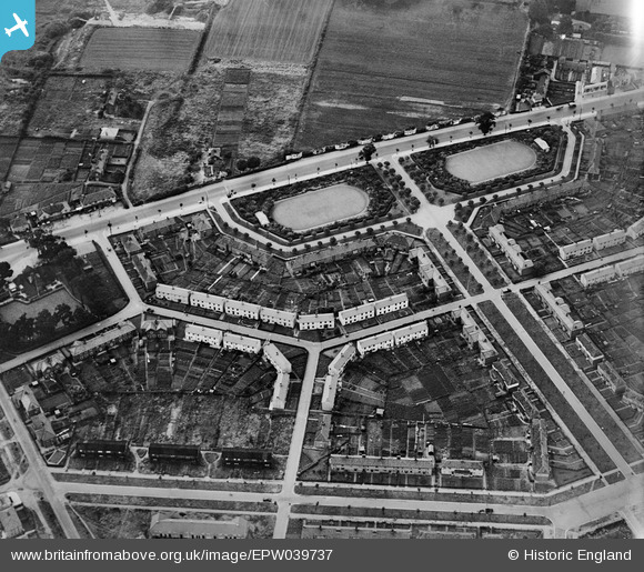
EPW039737 ENGLAND (1932). Losinga Crescent, Bolingbroke Road and Suckling Avenue, Upper Hellesdon, 1932
© Copyright OpenStreetMap contributors and licensed by the OpenStreetMap Foundation. 2026. Cartography is licensed as CC BY-SA.
Details
| Title | [EPW039737] Losinga Crescent, Bolingbroke Road and Suckling Avenue, Upper Hellesdon, 1932 |
| Reference | EPW039737 |
| Date | 23-July-1932 |
| Link | |
| Place name | UPPER HELLESDON |
| Parish | |
| District | |
| Country | ENGLAND |
| Easting / Northing | 621749, 311362 |
| Longitude / Latitude | 1.2789013351465, 52.654217048812 |
| National Grid Reference | TG217114 |
Pins

Chris Lambert |
Sunday 12th of April 2015 04:57:26 PM |


![[EPW039737] Losinga Crescent, Bolingbroke Road and Suckling Avenue, Upper Hellesdon, 1932](http://britainfromabove.org.uk/sites/all/libraries/aerofilms-images/public/100x100/EPW/039/EPW039737.jpg)
![[EPW039741] Losinga Crescent, Rye Avenue and Tallow Factory, Upper Hellesdon, 1932](http://britainfromabove.org.uk/sites/all/libraries/aerofilms-images/public/100x100/EPW/039/EPW039741.jpg)