
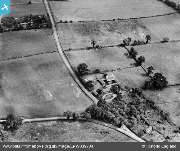
EPW039734 ENGLAND (1932). Yew Tree Farm, Forncett St Mary, 1932
© Copyright OpenStreetMap contributors and licensed by the OpenStreetMap Foundation. 2026. Cartography is licensed as CC BY-SA.
Nearby Images (2)
EPW039734

EPW039733

Details
| Title | [EPW039734] Yew Tree Farm, Forncett St Mary, 1932 |
| Reference | EPW039734 |
| Date | August-1932 |
| Link | |
| Place name | FORNCETT ST MARY |
| Parish | FORNCETT |
| District | |
| Country | ENGLAND |
| Easting / Northing | 616737, 294674 |
| Longitude / Latitude | 1.1940005094, 52.506437681739 |
| National Grid Reference | TM167947 |
Pins

Class31 |
Saturday 19th of October 2013 11:55:17 PM | |
|
Class31 |
Saturday 19th of October 2013 11:38:04 PM | |

BigglesH |
Monday 24th of June 2013 01:32:16 PM | |
|
Rebecca |
Sunday 26th of May 2013 03:11:26 PM | |
|
changie2012 |
Sunday 7th of April 2013 03:25:46 PM | |
|
changie2012 |
Sunday 7th of April 2013 03:24:37 PM | |
|
changie2012 |
Sunday 7th of April 2013 03:23:32 PM |
User Comment Contributions
low road. Forncett saint Mary |
c |
Friday 1st of November 2013 03:53:02 PM |
Really good to locate this one! Well done c. |
Class31 |
Saturday 19th of October 2013 11:57:21 PM |
Thanks for looking at these c, we'll update the catalogue with the new information and post the updated record here in due course. You may be interested to know that the original Aerofilms Ltd Register entry is blank. Yours, Katy Britain from Above Cataloguing Team Leader |
Katy Whitaker |
Friday 1st of November 2013 03:53:02 PM |
View looking north east. |
Class31 |
Saturday 19th of October 2013 11:56:23 PM |
Same group of buildings and ?shrunken settlement as in EPW039733, but taken from the other direction (c180 deg) |
Rebecca |
Wednesday 9th of January 2013 01:33:35 PM |