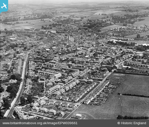
EPW039661 ENGLAND (1932). The town, Newport, from the south-west, 1932
© Copyright OpenStreetMap contributors and licensed by the OpenStreetMap Foundation. 2024. Cartography is licensed as CC BY-SA.
Details
| Title | [EPW039661] The town, Newport, from the south-west, 1932 |
| Reference | EPW039661 |
| Date | 12-August-1932 |
| Link | |
| Place name | NEWPORT |
| Parish | NEWPORT |
| District | |
| Country | ENGLAND |
| Easting / Northing | 449543, 88733 |
| Longitude / Latitude | -1.298463385331, 50.695553940717 |
| National Grid Reference | SZ495887 |
Pins
 Chris |
Tuesday 10th of December 2024 05:13:27 PM | |
 MB |
Monday 4th of February 2013 06:18:51 PM | |
 MB |
Monday 4th of February 2013 06:18:27 PM | |
 MB |
Monday 4th of February 2013 06:16:29 PM | |
 MB |
Monday 4th of February 2013 06:15:20 PM | |
 MB |
Monday 4th of February 2013 06:10:29 PM | |
 MB |
Monday 4th of February 2013 06:10:07 PM | |
 MB |
Monday 4th of February 2013 06:09:06 PM | |
 MB |
Monday 4th of February 2013 06:08:06 PM | |
 MB |
Monday 4th of February 2013 06:05:15 PM | |
 MB |
Monday 4th of February 2013 06:04:49 PM | |
 steve |
Sunday 13th of January 2013 08:36:17 PM | |
 steve |
Sunday 13th of January 2013 08:35:03 PM |
User Comment Contributions
Newport from Carisbrooke Castle |
 Class31 |
Sunday 23rd of June 2013 08:15:02 PM |


![[EPW039661] The town, Newport, from the south-west, 1932](http://britainfromabove.org.uk/sites/all/libraries/aerofilms-images/public/100x100/EPW/039/EPW039661.jpg)
![[EPW032332] The town and surroundings, Newport, from the west, 1930](http://britainfromabove.org.uk/sites/all/libraries/aerofilms-images/public/100x100/EPW/032/EPW032332.jpg)