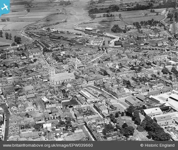
EPW039660 ENGLAND (1932). St Thomas's Church and the town centre, Newport, 1932
© Copyright OpenStreetMap contributors and licensed by the OpenStreetMap Foundation. 2026. Cartography is licensed as CC BY-SA.
Nearby Images (10)
Details
| Title | [EPW039660] St Thomas's Church and the town centre, Newport, 1932 |
| Reference | EPW039660 |
| Date | 12-August-1932 |
| Link | |
| Place name | NEWPORT |
| Parish | NEWPORT |
| District | |
| Country | ENGLAND |
| Easting / Northing | 450027, 89168 |
| Longitude / Latitude | -1.2915514918702, 50.699424477808 |
| National Grid Reference | SZ500892 |


![[EPW039660] St Thomas's Church and the town centre, Newport, 1932](http://britainfromabove.org.uk/sites/all/libraries/aerofilms-images/public/100x100/EPW/039/EPW039660.jpg)
![[EPW032329] St Thomas's Church, the Football Ground and the town centre, Newport, 1930](http://britainfromabove.org.uk/sites/all/libraries/aerofilms-images/public/100x100/EPW/032/EPW032329.jpg)
![[EPW032330] The town, Newport, 1930](http://britainfromabove.org.uk/sites/all/libraries/aerofilms-images/public/100x100/EPW/032/EPW032330.jpg)
![[EPW032333] St Thomas's Church and the town centre, Newport, 1930](http://britainfromabove.org.uk/sites/all/libraries/aerofilms-images/public/100x100/EPW/032/EPW032333.jpg)
![[EAW022224] The town, Newport, 1949](http://britainfromabove.org.uk/sites/all/libraries/aerofilms-images/public/100x100/EAW/022/EAW022224.jpg)
![[EPW023021] St James's Square, St Thomas's Church and environs, Newport, 1928. This image has been produced from a copy-negative.](http://britainfromabove.org.uk/sites/all/libraries/aerofilms-images/public/100x100/EPW/023/EPW023021.jpg)
![[EAW022225] The town, Newport, 1949](http://britainfromabove.org.uk/sites/all/libraries/aerofilms-images/public/100x100/EAW/022/EAW022225.jpg)
![[EAW015247] The town, Newport, from the north-east, 1948](http://britainfromabove.org.uk/sites/all/libraries/aerofilms-images/public/100x100/EAW/015/EAW015247.jpg)
![[EAW003000] The town and River Medina looking towards The Solent, Newport, from the south, 1946](http://britainfromabove.org.uk/sites/all/libraries/aerofilms-images/public/100x100/EAW/003/EAW003000.jpg)
![[EPW023022] High Street, Newport, 1928](http://britainfromabove.org.uk/sites/all/libraries/aerofilms-images/public/100x100/EPW/023/EPW023022.jpg)
