
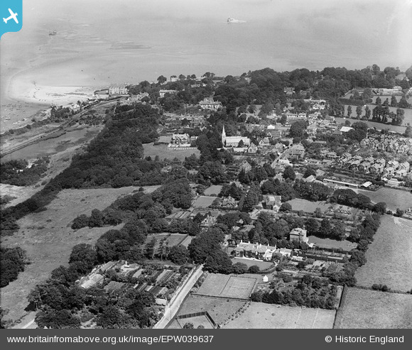
EPW039637 ENGLAND (1932). Holy Trinity Church, the High Street and environs, Bembridge, 1932
© Copyright OpenStreetMap contributors and licensed by the OpenStreetMap Foundation. 2026. Cartography is licensed as CC BY-SA.
Nearby Images (2)
EPW039637

EPW039638

Details
| Title | [EPW039637] Holy Trinity Church, the High Street and environs, Bembridge, 1932 |
| Reference | EPW039637 |
| Date | 12-August-1932 |
| Link | |
| Place name | BEMBRIDGE |
| Parish | BEMBRIDGE |
| District | |
| Country | ENGLAND |
| Easting / Northing | 464275, 88151 |
| Longitude / Latitude | -1.0899820884752, 50.688878362455 |
| National Grid Reference | SZ643882 |
Pins

SteveAUS |
Tuesday 19th of February 2013 04:26:53 AM | |
Yes, this would be St Helen's Fort, at the end of a sandbar, east of Node's Point. Its shell was still there in the 1990's. |
Gerald Maull |
Sunday 28th of December 2014 11:01:44 PM |