
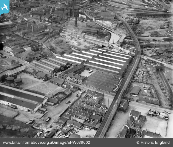
EPW039602 ENGLAND (1932). The Canal (Electric Battery) Works, Wolverhampton, 1932
© Copyright OpenStreetMap contributors and licensed by the OpenStreetMap Foundation. 2026. Cartography is licensed as CC BY-SA.
Nearby Images (8)
EPW039602
 Works, Wolverhampton, 1932")
EPW039598
 Works, Wolverhampton, 1932")
EPW039604
 Works, Wolverhampton, 1932")
EPW039601
 Works, Wolverhampton, 1932")
EPW039603
 Works, Wolverhampton, 1932")
EPW039600
 Works, Wolverhampton, 1932")
EPW039599
 Works, Wolverhampton, 1932")
EPW039605
 Works, Wolverhampton, 1932")
Details
| Title | [EPW039602] The Canal (Electric Battery) Works, Wolverhampton, 1932 |
| Reference | EPW039602 |
| Date | August-1932 |
| Link | |
| Place name | WOLVERHAMPTON |
| Parish | |
| District | |
| Country | ENGLAND |
| Easting / Northing | 392475, 298446 |
| Longitude / Latitude | -2.1110733992255, 52.583413437376 |
| National Grid Reference | SO925984 |
Pins

Mike |
Thursday 12th of November 2015 11:28:56 PM | |
|
Mike |
Thursday 12th of November 2015 11:26:13 PM | |
|
Mike |
Thursday 12th of November 2015 11:25:40 PM | |
|
Mike |
Thursday 12th of November 2015 11:25:17 PM | |
|
Mike |
Thursday 12th of November 2015 11:24:25 PM | |

bescotbeast |
Monday 22nd of September 2014 12:43:23 PM |