
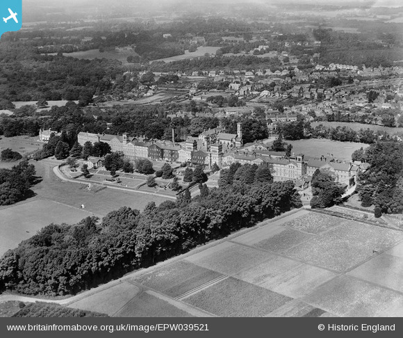
EPW039521 ENGLAND (1932). The Brighton County Borough Psychiatric Hospital and environs, Haywards Heath, 1932
© Copyright OpenStreetMap contributors and licensed by the OpenStreetMap Foundation. 2026. Cartography is licensed as CC BY-SA.
Nearby Images (3)
EPW039521

EPW039523

EPW039522

Details
| Title | [EPW039521] The Brighton County Borough Psychiatric Hospital and environs, Haywards Heath, 1932 |
| Reference | EPW039521 |
| Date | August-1932 |
| Link | |
| Place name | HAYWARDS HEATH |
| Parish | HAYWARDS HEATH |
| District | |
| Country | ENGLAND |
| Easting / Northing | 533706, 122823 |
| Longitude / Latitude | -0.094737717266554, 50.988716085494 |
| National Grid Reference | TQ337228 |
Pins

Dan Gregory |
Wednesday 4th of June 2014 03:01:36 PM | |
|
Dan Gregory |
Wednesday 4th of June 2014 03:01:12 PM | |
|
Dan Gregory |
Wednesday 4th of June 2014 02:59:51 PM | |
|
Dan Gregory |
Wednesday 4th of June 2014 02:59:17 PM | |
|
Dan Gregory |
Wednesday 4th of June 2014 02:58:35 PM | |
|
Dan Gregory |
Wednesday 4th of June 2014 02:57:45 PM | |
|
Dan Gregory |
Wednesday 4th of June 2014 02:57:10 PM | |
|
Dan Gregory |
Wednesday 4th of June 2014 02:56:33 PM |