
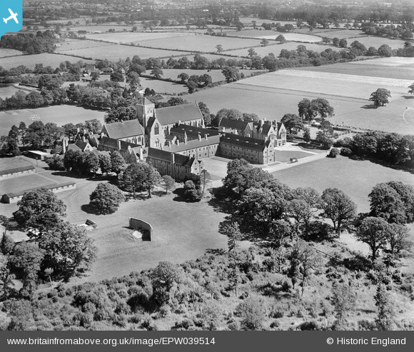
EPW039514 ENGLAND (1932). Hurstpierpoint College, Hurstpierpoint, 1932
© Copyright OpenStreetMap contributors and licensed by the OpenStreetMap Foundation. 2026. Cartography is licensed as CC BY-SA.
Nearby Images (5)
EPW039514

EPW039513

EPW039512

EPW039515

EPW039516

Details
| Title | [EPW039514] Hurstpierpoint College, Hurstpierpoint, 1932 |
| Reference | EPW039514 |
| Date | August-1932 |
| Link | |
| Place name | HURSTPIERPOINT |
| Parish | HURSTPIERPOINT AND SAYERS COMMON |
| District | |
| Country | ENGLAND |
| Easting / Northing | 528985, 117546 |
| Longitude / Latitude | -0.163844062975, 50.94236019599 |
| National Grid Reference | TQ290175 |
Pins

Mary |
Tuesday 21st of May 2013 10:14:53 PM | |
|
Mary |
Tuesday 21st of May 2013 10:01:53 PM | |
|
Mary |
Tuesday 21st of May 2013 10:01:02 PM | |
|
Mary |
Tuesday 21st of May 2013 10:00:39 PM | |
|
SteveAUS |
Wednesday 27th of February 2013 02:01:03 AM | |
could it be a rifle/gun range with sand in front of the wall? |
SteveAUS |
Wednesday 27th of February 2013 02:02:15 AM |
User Comment Contributions
This was protective wall at the end of the outdoor shooting range, according to my husband who is an old boy of the school. |
Mary |
Tuesday 21st of May 2013 10:00:11 PM |