
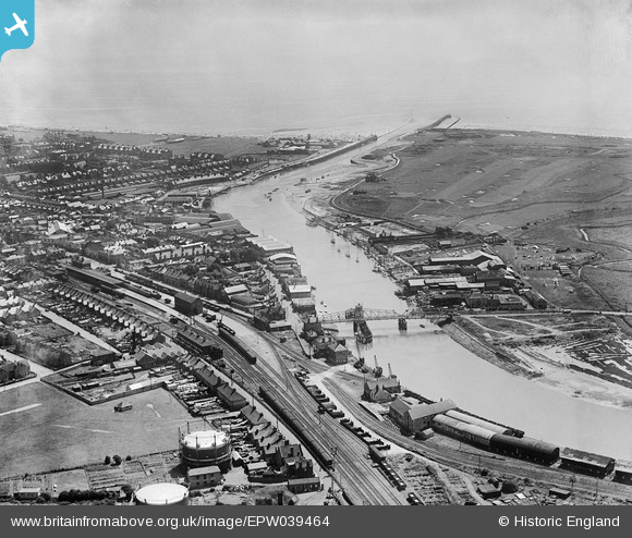
EPW039464 ENGLAND (1932). Littlehampton Railway Station, the mouth of the River Arun and Littlehampton Golf Course, Littlehampton, 1932
© Copyright OpenStreetMap contributors and licensed by the OpenStreetMap Foundation. 2026. Cartography is licensed as CC BY-SA.
Nearby Images (8)
EPW039464

EPW039465

EPW020176

EAW012229

EPW039463

EAW012228

EAW012239

EPW017753

Details
| Title | [EPW039464] Littlehampton Railway Station, the mouth of the River Arun and Littlehampton Golf Course, Littlehampton, 1932 |
| Reference | EPW039464 |
| Date | August-1932 |
| Link | |
| Place name | LITTLEHAMPTON |
| Parish | LITTLEHAMPTON |
| District | |
| Country | ENGLAND |
| Easting / Northing | 502398, 102025 |
| Longitude / Latitude | -0.54652149046506, 50.808154346886 |
| National Grid Reference | TQ024020 |
Pins

bigherb |
Thursday 29th of October 2020 12:16:40 PM | |
|
John W |
Sunday 18th of September 2016 03:59:31 PM | |
|
John W |
Sunday 18th of September 2016 03:58:49 PM | |
|
JerryE |
Wednesday 16th of October 2013 09:42:41 PM | |
|
JerryE |
Wednesday 16th of October 2013 09:41:50 PM | |
|
JerryE |
Wednesday 16th of October 2013 09:36:37 PM | |
|
martin |
Sunday 7th of July 2013 04:59:27 PM |