
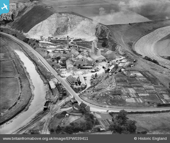
EPW039411 ENGLAND (1932). The Lewes Cement Works, Lewes, 1932
© Copyright OpenStreetMap contributors and licensed by the OpenStreetMap Foundation. 2026. Cartography is licensed as CC BY-SA.
Nearby Images (6)
EPW039411

EPW039412

EPW039407

EPW039410

EPW039408

EPW039409

Details
| Title | [EPW039411] The Lewes Cement Works, Lewes, 1932 |
| Reference | EPW039411 |
| Date | August-1932 |
| Link | |
| Place name | LEWES |
| Parish | LEWES |
| District | |
| Country | ENGLAND |
| Easting / Northing | 542586, 109440 |
| Longitude / Latitude | 0.026481808767594, 50.866301597048 |
| National Grid Reference | TQ426094 |
Pins

Dylan Moore |
Saturday 9th of March 2013 06:23:05 PM | |
|
Dylan Moore |
Saturday 9th of March 2013 06:22:26 PM | |
|
Dylan Moore |
Saturday 9th of March 2013 06:21:57 PM | |
|
Dylan Moore |
Saturday 9th of March 2013 06:21:18 PM |