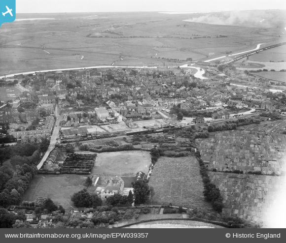
EPW039357 ENGLAND (1932). The town, Rye, from the north-west, 1932
    © Copyright OpenStreetMap contributors and licensed by the OpenStreetMap Foundation. 2025. Cartography is licensed as CC BY-SA.
  
Nearby Images (5)
Details
| Title | [EPW039357] The town, Rye, from the north-west, 1932 | 
| Reference | EPW039357 | 
| Date | July-1932 | 
| Link | |
| Place name | RYE | 
| Parish | RYE | 
| District | |
| Country | ENGLAND | 
| Easting / Northing | 591929, 120776 | 
| Longitude / Latitude | 0.73298187620616, 50.953861669316 | 
| National Grid Reference | TQ919208 | 
Pins
|  WHITEFRIARS, CONDUIT HILL |   glennhughz | Thursday 10th of April 2014 10:27:12 AM | 
|  Rye railway station |   somoody | Friday 3rd of May 2013 11:26:00 PM | 
|  Parish Church of St. Mary the Virgin | Class31 | Thursday 24th of January 2013 10:07:28 PM | 
 
             
  ![[EPW039357] The town, Rye, from the north-west, 1932](http://britainfromabove.org.uk/sites/all/libraries/aerofilms-images/public/100x100/EPW/039/EPW039357.jpg) 
  
                                          ![[EAW014594] The town, Rye, from the north-west, 1948](http://britainfromabove.org.uk/sites/all/libraries/aerofilms-images/public/100x100/EAW/014/EAW014594.jpg) 
 ![[EPW026241] The railway station and cattle market, Rye, 1929](http://britainfromabove.org.uk/sites/all/libraries/aerofilms-images/public/100x100/EPW/026/EPW026241.jpg) 
 ![[EPW035364] The town, Rye, from the north-west, 1931](http://britainfromabove.org.uk/sites/all/libraries/aerofilms-images/public/100x100/EPW/035/EPW035364.jpg) 
 ![[EAW014593] The town, Rye, from the north-west, 1948](http://britainfromabove.org.uk/sites/all/libraries/aerofilms-images/public/100x100/EAW/014/EAW014593.jpg)