
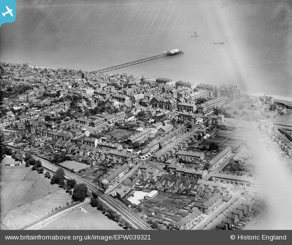
EPW039321 ENGLAND (1932). The town and pier, Deal, from the south-west, 1932. This image has been affected by flare.
© Copyright OpenStreetMap contributors and licensed by the OpenStreetMap Foundation. 2026. Cartography is licensed as CC BY-SA.
Nearby Images (13)
EPW039321

EPW019059

EPW000640

EPW035434

EAW014342

EAW014343

EAW014345

EPW035438

EAW014346

EPW009182

EPW035432

EPW000333

EPW035435

Details
| Title | [EPW039321] The town and pier, Deal, from the south-west, 1932. This image has been affected by flare. |
| Reference | EPW039321 |
| Date | July-1932 |
| Link | |
| Place name | DEAL |
| Parish | DEAL |
| District | |
| Country | ENGLAND |
| Easting / Northing | 637537, 152195 |
| Longitude / Latitude | 1.4019715206744, 51.218934942117 |
| National Grid Reference | TR375522 |
Pins

Alan McFaden |
Wednesday 9th of July 2014 10:34:02 AM | |
|
Alan McFaden |
Wednesday 9th of July 2014 10:33:34 AM | |
|
Alan McFaden |
Wednesday 9th of July 2014 10:33:08 AM | |
|
Alan McFaden |
Wednesday 9th of July 2014 10:32:37 AM |


