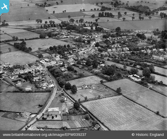
EPW039237 ENGLAND (1932). The town centre, Attleborough, 1932
© Copyright OpenStreetMap contributors and licensed by the OpenStreetMap Foundation. 2024. Cartography is licensed as CC BY-SA.
Details
| Title | [EPW039237] The town centre, Attleborough, 1932 |
| Reference | EPW039237 |
| Date | July-1932 |
| Link | |
| Place name | ATTLEBOROUGH |
| Parish | ATTLEBOROUGH |
| District | |
| Country | ENGLAND |
| Easting / Northing | 604621, 295130 |
| Longitude / Latitude | 1.0160072406356, 52.515213444736 |
| National Grid Reference | TM046951 |
Pins
 Gasometerman |
Thursday 2nd of July 2020 02:00:12 PM | |
 bugbear |
Thursday 24th of October 2013 03:03:30 PM | |
 bugbear |
Thursday 24th of October 2013 03:03:15 PM | |
 bugbear |
Thursday 24th of October 2013 03:02:54 PM | |
 bugbear |
Thursday 24th of October 2013 03:02:01 PM | |
 bugbear |
Thursday 24th of October 2013 03:01:43 PM | |
 bugbear |
Thursday 24th of October 2013 02:55:45 PM |


![[EPW039237] The town centre, Attleborough, 1932](http://britainfromabove.org.uk/sites/all/libraries/aerofilms-images/public/100x100/EPW/039/EPW039237.jpg)
![[EPW021558] Church Street and environs, Attleborough, 1928](http://britainfromabove.org.uk/sites/all/libraries/aerofilms-images/public/100x100/EPW/021/EPW021558.jpg)