
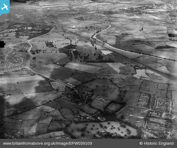
EPW039109 ENGLAND (1932). Lupset Park and surrounding countryside, Lupset, from the west, 1932
© Copyright OpenStreetMap contributors and licensed by the OpenStreetMap Foundation. 2026. Cartography is licensed as CC BY-SA.
Nearby Images (3)
EPW039109

EPW039107

EPW039110

Details
| Title | [EPW039109] Lupset Park and surrounding countryside, Lupset, from the west, 1932 |
| Reference | EPW039109 |
| Date | July-1932 |
| Link | |
| Place name | LUPSET |
| Parish | |
| District | |
| Country | ENGLAND |
| Easting / Northing | 430505, 418694 |
| Longitude / Latitude | -1.5382947101554, 53.663608676436 |
| National Grid Reference | SE305187 |
Pins

Jimster_FTO |
Wednesday 7th of January 2015 09:10:48 PM | |
|
Jimster_FTO |
Wednesday 7th of January 2015 09:09:56 PM |