
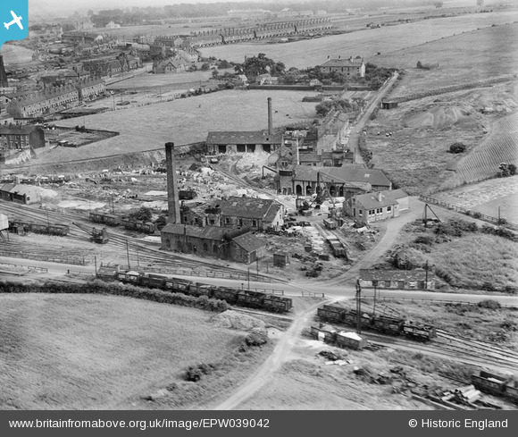
EPW039042 ENGLAND (1932). Level Crossing at Thorpe Lower Lane and environs, Robin Hood, 1932
© Copyright OpenStreetMap contributors and licensed by the OpenStreetMap Foundation. 2025. Cartography is licensed as CC BY-SA.
Nearby Images (3)
EPW039042

EPW039041

EPW039040

Details
| Title | [EPW039042] Level Crossing at Thorpe Lower Lane and environs, Robin Hood, 1932 |
| Reference | EPW039042 |
| Date | July-1932 |
| Link | |
| Place name | ROBIN HOOD |
| Parish | |
| District | |
| Country | ENGLAND |
| Easting / Northing | 432314, 427177 |
| Longitude / Latitude | -1.5100309579371, 53.739752230188 |
| National Grid Reference | SE323272 |
Pins

Catherine |
Sunday 11th of May 2025 10:38:48 PM | |
|
Catherine |
Sunday 11th of May 2025 10:35:01 PM | |
|
MB |
Friday 11th of April 2014 04:15:44 PM | |
|
MB |
Friday 11th of April 2014 04:12:05 PM |