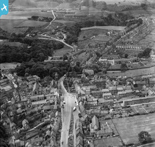
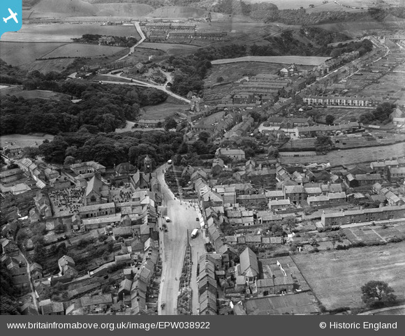
EPW038922 ENGLAND (1932). The Market Place and town centre, Loftus, 1932
© Copyright OpenStreetMap contributors and licensed by the OpenStreetMap Foundation. 2026. Cartography is licensed as CC BY-SA.
Nearby Images (3)
EPW038922

EPW029109

EPW038923

Details
| Title | [EPW038922] The Market Place and town centre, Loftus, 1932 |
| Reference | EPW038922 |
| Date | July-1932 |
| Link | |
| Place name | LOFTUS |
| Parish | LOFTUS |
| District | |
| Country | ENGLAND |
| Easting / Northing | 472081, 518188 |
| Longitude / Latitude | -0.8853867189084, 54.553670891917 |
| National Grid Reference | NZ721182 |
Pins

David Richardson |
Saturday 15th of December 2012 10:02:41 PM | |
|
David Richardson |
Saturday 15th of December 2012 10:01:48 PM |