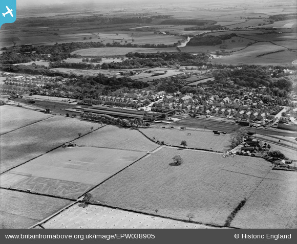
EPW038905 ENGLAND (1932). The town and surrounding countryside, Eaglescliffe, 1932
© Copyright OpenStreetMap contributors and licensed by the OpenStreetMap Foundation. 2026. Cartography is licensed as CC BY-SA.
Details
| Title | [EPW038905] The town and surrounding countryside, Eaglescliffe, 1932 |
| Reference | EPW038905 |
| Date | July-1932 |
| Link | |
| Place name | EAGLESCLIFFE |
| Parish | EGGLESCLIFFE |
| District | |
| Country | ENGLAND |
| Easting / Northing | 442155, 515087 |
| Longitude / Latitude | -1.3485418372683, 54.529179082456 |
| National Grid Reference | NZ422151 |
Pins

J May |
Friday 14th of April 2023 02:03:39 PM | |

Fantasma |
Monday 10th of June 2013 05:19:11 PM | |

Fantasma |
Monday 10th of June 2013 05:18:37 PM | |

Fantasma |
Monday 10th of June 2013 05:17:56 PM | |

Fantasma |
Monday 10th of June 2013 05:17:16 PM | |

Fantasma |
Monday 10th of June 2013 05:15:30 PM |


![[EPW038905] The town and surrounding countryside, Eaglescliffe, 1932](http://britainfromabove.org.uk/sites/all/libraries/aerofilms-images/public/100x100/EPW/038/EPW038905.jpg)
![[EPW038903] Eaglescliffe Railway Station and the town centre, Eaglescliffe, 1932](http://britainfromabove.org.uk/sites/all/libraries/aerofilms-images/public/100x100/EPW/038/EPW038903.jpg)
![[EPW038904] The town and surrounding countryside, Eaglescliffe, 1932](http://britainfromabove.org.uk/sites/all/libraries/aerofilms-images/public/100x100/EPW/038/EPW038904.jpg)