
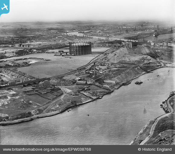
EPW038768 ENGLAND (1932). Windhill Road Gasometer and surrounding industry on the River Tyne, St Anthony's, from the south-west, 1932
© Copyright OpenStreetMap contributors and licensed by the OpenStreetMap Foundation. 2025. Cartography is licensed as CC BY-SA.
Nearby Images (2)
EPW038768

EPW038767

Details
| Title | [EPW038768] Windhill Road Gasometer and surrounding industry on the River Tyne, St Anthony's, from the south-west, 1932 |
| Reference | EPW038768 |
| Date | June-1932 |
| Link | |
| Place name | ST ANTHONY'S |
| Parish | |
| District | |
| Country | ENGLAND |
| Easting / Northing | 428886, 562940 |
| Longitude / Latitude | -1.548835669481, 54.960179922054 |
| National Grid Reference | NZ289629 |
Pins
Be the first to add a comment to this image!