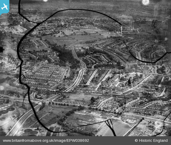
EPW038692 ENGLAND (1932). Brent Park and housing off the North Circular Road, Golders Green, from the south-west, 1932. This image has been produced from a damaged negative.
© Copyright OpenStreetMap contributors and licensed by the OpenStreetMap Foundation. 2026. Cartography is licensed as CC BY-SA.
Nearby Images (5)
Details
| Title | [EPW038692] Brent Park and housing off the North Circular Road, Golders Green, from the south-west, 1932. This image has been produced from a damaged negative. |
| Reference | EPW038692 |
| Date | June-1932 |
| Link | |
| Place name | GOLDERS GREEN |
| Parish | |
| District | |
| Country | ENGLAND |
| Easting / Northing | 523727, 187933 |
| Longitude / Latitude | -0.21430177460766, 51.576190873239 |
| National Grid Reference | TQ237879 |
Pins

John W |
Thursday 30th of March 2017 09:22:24 PM |


![[EPW038692] Brent Park and housing off the North Circular Road, Golders Green, from the south-west, 1932. This image has been produced from a damaged negative.](http://britainfromabove.org.uk/sites/all/libraries/aerofilms-images/public/100x100/EPW/038/EPW038692.jpg)
![[EPW008213] The Underground Electric Railways Company of London Ltd (UERL) extension from Golders Green to Hendon and Edgware under construction, Golders Green, 1922. This image has been produced from a copy-negative.](http://britainfromabove.org.uk/sites/all/libraries/aerofilms-images/public/100x100/EPW/008/EPW008213.jpg)
![[EPW038693] Brent Park and housing off the North Circular Road, Golders Green, from the south-west, 1932](http://britainfromabove.org.uk/sites/all/libraries/aerofilms-images/public/100x100/EPW/038/EPW038693.jpg)
![[EPW016526] Brent Cross underground station and environs, Golders Green, 1926](http://britainfromabove.org.uk/sites/all/libraries/aerofilms-images/public/100x100/EPW/016/EPW016526.jpg)
![[EPW052468] Brent Cross and Clive Lodge, Hendon, 1937. This image has been produced from a print.](http://britainfromabove.org.uk/sites/all/libraries/aerofilms-images/public/100x100/EPW/052/EPW052468.jpg)