
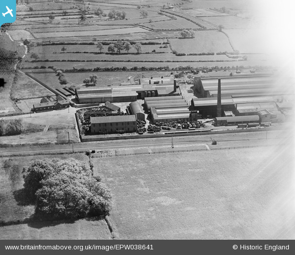
EPW038641 ENGLAND (1932). Lowfield Foundry, Newark-on-Trent, 1932
© Copyright OpenStreetMap contributors and licensed by the OpenStreetMap Foundation. 2026. Cartography is licensed as CC BY-SA.
Nearby Images (8)
EPW038641

EPW038636

EPW038633

EPW038639

EPW038635

EPW038638

EPW038637

EPW038642

Details
| Title | [EPW038641] Lowfield Foundry, Newark-on-Trent, 1932 |
| Reference | EPW038641 |
| Date | June-1932 |
| Link | |
| Place name | NEWARK-ON-TRENT |
| Parish | BALDERTON |
| District | |
| Country | ENGLAND |
| Easting / Northing | 480618, 351274 |
| Longitude / Latitude | -0.79713006367906, 53.052334593103 |
| National Grid Reference | SK806513 |
Pins

John Wass |
Wednesday 27th of May 2015 03:33:13 PM |