
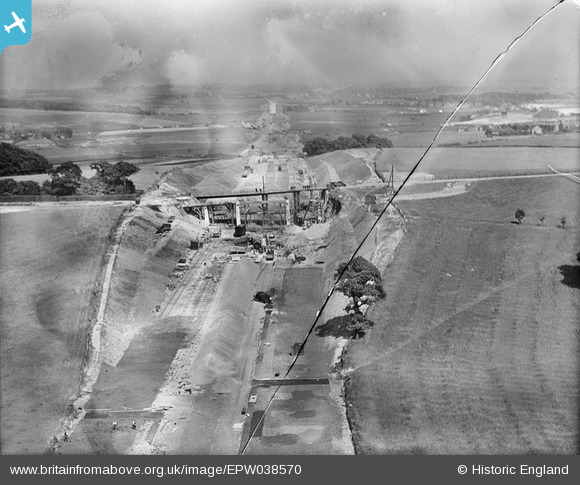
EPW038570 ENGLAND (1932). The East Lancashire Road (A580) and Windle Hall Bridge under construction, St Helens, from the west, 1932. This image has been produced from a damaged negative.
© Copyright OpenStreetMap contributors and licensed by the OpenStreetMap Foundation. 2026. Cartography is licensed as CC BY-SA.
Nearby Images (3)
EPW038570
 and Windle Hall Bridge under construction, St Helens, from the west, 1932. This image has been produced from a damaged negative.")
EPW038572
 and Windle Hall Bridge under construction, St Helens, from the west, 1932")
EPW038571
 and Windle Hall Bridge under construction, St Helens, from the north-west, 1932")
Details
| Title | [EPW038570] The East Lancashire Road (A580) and Windle Hall Bridge under construction, St Helens, from the west, 1932. This image has been produced from a damaged negative. |
| Reference | EPW038570 |
| Date | June-1932 |
| Link | |
| Place name | ST HELENS |
| Parish | |
| District | |
| Country | ENGLAND |
| Easting / Northing | 349766, 397269 |
| Longitude / Latitude | -2.7568423073026, 53.469505037939 |
| National Grid Reference | SJ498973 |
Pins
Be the first to add a comment to this image!