
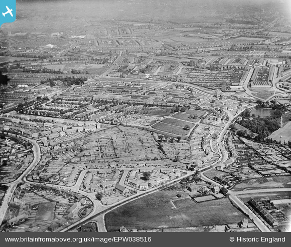
EPW038516 ENGLAND (1932). New housing estates off Warley Road, Thimblemill Road and the Uplands Cemetery, Smethwick, from the west, 1932
© Copyright OpenStreetMap contributors and licensed by the OpenStreetMap Foundation. 2026. Cartography is licensed as CC BY-SA.
Nearby Images (3)
EPW038516

EPW017031

EPW017032

Details
| Title | [EPW038516] New housing estates off Warley Road, Thimblemill Road and the Uplands Cemetery, Smethwick, from the west, 1932 |
| Reference | EPW038516 |
| Date | June-1932 |
| Link | |
| Place name | SMETHWICK |
| Parish | |
| District | |
| Country | ENGLAND |
| Easting / Northing | 401501, 287411 |
| Longitude / Latitude | -1.977894220344, 52.484248593487 |
| National Grid Reference | SP015874 |
Pins

mikbex |
Sunday 30th of January 2022 09:41:04 PM | |
|
Kevin |
Saturday 13th of August 2016 01:47:58 AM | |
|
Kevin |
Saturday 13th of August 2016 01:47:07 AM | |
|
Kevin |
Saturday 13th of August 2016 01:46:00 AM | |
|
Kevin |
Saturday 13th of August 2016 01:44:59 AM | |
|
Kevin |
Saturday 13th of August 2016 01:42:18 AM | |
|
Rob |
Monday 8th of February 2016 09:39:25 PM | |
|
lee |
Sunday 7th of February 2016 12:05:37 PM | |
|
lee |
Sunday 7th of February 2016 12:04:44 PM | |
|
lee |
Sunday 7th of February 2016 12:03:40 PM | |
|
lee |
Sunday 7th of February 2016 12:03:00 PM | |
|
lee |
Sunday 7th of February 2016 12:02:09 PM | |
|
artscotak2 |
Saturday 12th of January 2013 07:13:08 PM | |
|
artscotak2 |
Saturday 12th of January 2013 07:12:06 PM |