
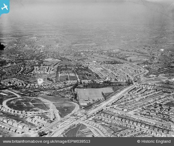
EPW038513 ENGLAND (1932). New housing estates under construction at The Oval and alongside Norman Road and the Uplands Cemetery, Smethwick, from the south-west, 1932
© Copyright OpenStreetMap contributors and licensed by the OpenStreetMap Foundation. 2025. Cartography is licensed as CC BY-SA.
Nearby Images (3)
EPW038513

EPW038514

EPW018364

Details
| Title | [EPW038513] New housing estates under construction at The Oval and alongside Norman Road and the Uplands Cemetery, Smethwick, from the south-west, 1932 |
| Reference | EPW038513 |
| Date | June-1932 |
| Link | |
| Place name | SMETHWICK |
| Parish | |
| District | |
| Country | ENGLAND |
| Easting / Northing | 401274, 287000 |
| Longitude / Latitude | -1.9812389047629, 52.480553868404 |
| National Grid Reference | SP013870 |
Pins

artscotak2 |
Saturday 12th of January 2013 06:50:04 PM | |
|
artscotak2 |
Saturday 12th of January 2013 06:48:41 PM | |
|
artscotak2 |
Saturday 12th of January 2013 06:47:27 PM |