
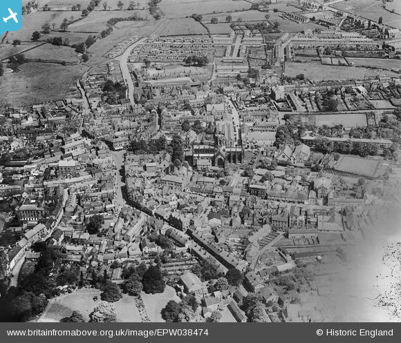
EPW038474 ENGLAND (1932). St Mary's Church and the town centre, Nantwich, 1932. This image has been produced from a damaged negative.
© Copyright OpenStreetMap contributors and licensed by the OpenStreetMap Foundation. 2026. Cartography is licensed as CC BY-SA.
Nearby Images (7)
EPW038474

EPW060149

EPW060148

EPW038471

EPW038475

EPW038472

EPW038473

Details
| Title | [EPW038474] St Mary's Church and the town centre, Nantwich, 1932. This image has been produced from a damaged negative. |
| Reference | EPW038474 |
| Date | June-1932 |
| Link | |
| Place name | NANTWICH |
| Parish | NANTWICH |
| District | |
| Country | ENGLAND |
| Easting / Northing | 365194, 352308 |
| Longitude / Latitude | -2.5194895490637, 53.06657696942 |
| National Grid Reference | SJ652523 |
