
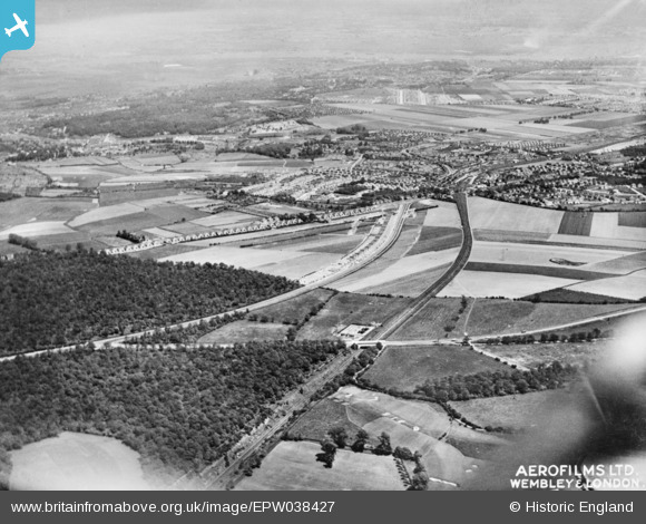
EPW038427 ENGLAND (1932). New housing site alongside Welling Way, Oxleas Wood and Bellegrove Road, Welling, from the south-west, 1932. This image has been produced from a copy-negative.
© Copyright OpenStreetMap contributors and licensed by the OpenStreetMap Foundation. 2025. Cartography is licensed as CC BY-SA.
Nearby Images (4)
EPW038427

EPW044277

EPW038417

EPW038269

Details
| Title | [EPW038427] New housing site alongside Welling Way, Oxleas Wood and Bellegrove Road, Welling, from the south-west, 1932. This image has been produced from a copy-negative. |
| Reference | EPW038427 |
| Date | 14-June-1932 |
| Link | |
| Place name | WELLING |
| Parish | |
| District | |
| Country | ENGLAND |
| Easting / Northing | 544783, 175613 |
| Longitude / Latitude | 0.084327178069684, 51.460461855018 |
| National Grid Reference | TQ448756 |
Pins
Be the first to add a comment to this image!