
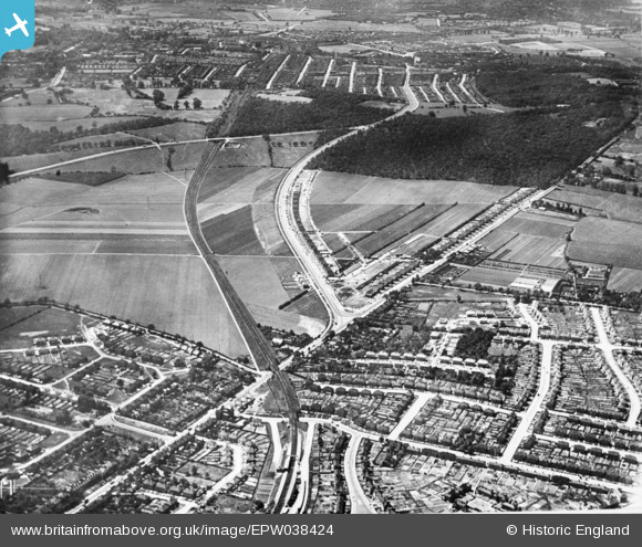
EPW038424 ENGLAND (1932). New housing site alongside Welling Way, Oxleas Wood and Bellegrove Road, Welling, 1932. This image has been produced from a copy-negative.
© Copyright OpenStreetMap contributors and licensed by the OpenStreetMap Foundation. 2025. Cartography is licensed as CC BY-SA.
Nearby Images (4)
EPW038424

EPW044276

EPW038426

EPW044356

Details
| Title | [EPW038424] New housing site alongside Welling Way, Oxleas Wood and Bellegrove Road, Welling, 1932. This image has been produced from a copy-negative. |
| Reference | EPW038424 |
| Date | 14-June-1932 |
| Link | |
| Place name | WELLING |
| Parish | |
| District | |
| Country | ENGLAND |
| Easting / Northing | 545384, 175905 |
| Longitude / Latitude | 0.093093195307875, 51.4629318633 |
| National Grid Reference | TQ454759 |
Pins
Be the first to add a comment to this image!