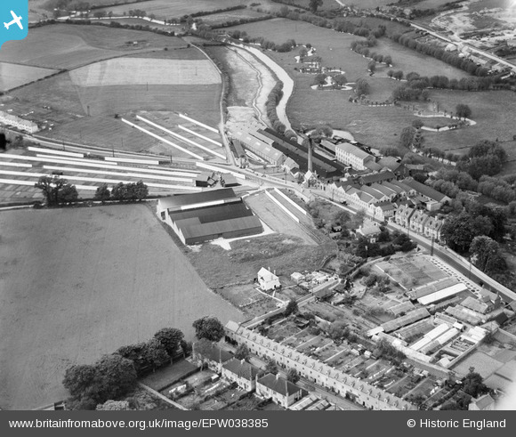
EPW038385 ENGLAND (1932). The Witney Mills, Witney, 1932
© Copyright OpenStreetMap contributors and licensed by the OpenStreetMap Foundation. 2025. Cartography is licensed as CC BY-SA.
Nearby Images (6)
Details
| Title | [EPW038385] The Witney Mills, Witney, 1932 |
| Reference | EPW038385 |
| Date | June-1932 |
| Link | |
| Place name | WITNEY |
| Parish | WITNEY |
| District | |
| Country | ENGLAND |
| Easting / Northing | 435442, 210280 |
| Longitude / Latitude | -1.4860877396834, 51.789601866982 |
| National Grid Reference | SP354103 |
Pins

Terry Hale |
Monday 10th of October 2016 03:42:44 PM | |

Eagle eye |
Sunday 8th of February 2015 09:47:32 PM |


![[EPW038385] The Witney Mills, Witney, 1932](http://britainfromabove.org.uk/sites/all/libraries/aerofilms-images/public/100x100/EPW/038/EPW038385.jpg)
![[EPW038383] The Witney Mills, Witney, 1932](http://britainfromabove.org.uk/sites/all/libraries/aerofilms-images/public/100x100/EPW/038/EPW038383.jpg)
![[EPW038384] The Witney Mills, Witney, 1932](http://britainfromabove.org.uk/sites/all/libraries/aerofilms-images/public/100x100/EPW/038/EPW038384.jpg)
![[EPW038382] The Witney Mills, Witney, 1932](http://britainfromabove.org.uk/sites/all/libraries/aerofilms-images/public/100x100/EPW/038/EPW038382.jpg)
![[EPW038386] The Witney Mills, Witney, 1932](http://britainfromabove.org.uk/sites/all/libraries/aerofilms-images/public/100x100/EPW/038/EPW038386.jpg)
![[EPW038380] The Witney Mills, Witney, 1932](http://britainfromabove.org.uk/sites/all/libraries/aerofilms-images/public/100x100/EPW/038/EPW038380.jpg)