
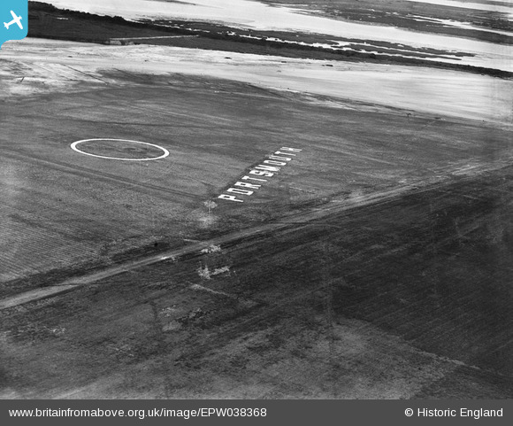
EPW038368 ENGLAND (1932). The Landing Circle at Portsmouth Aerodrome, Anchorage Park, 1932
© Copyright OpenStreetMap contributors and licensed by the OpenStreetMap Foundation. 2026. Cartography is licensed as CC BY-SA.
Nearby Images (7)
EPW038368

EPW038374

EPW038364

EPW038373

EPW038360

EPW038361

EPW038362

Details
| Title | [EPW038368] The Landing Circle at Portsmouth Aerodrome, Anchorage Park, 1932 |
| Reference | EPW038368 |
| Date | June-1932 |
| Link | |
| Place name | ANCHORAGE PARK |
| Parish | |
| District | |
| Country | ENGLAND |
| Easting / Northing | 466754, 103610 |
| Longitude / Latitude | -1.0520846423702, 50.827612954949 |
| National Grid Reference | SU668036 |
Pins
Be the first to add a comment to this image!