
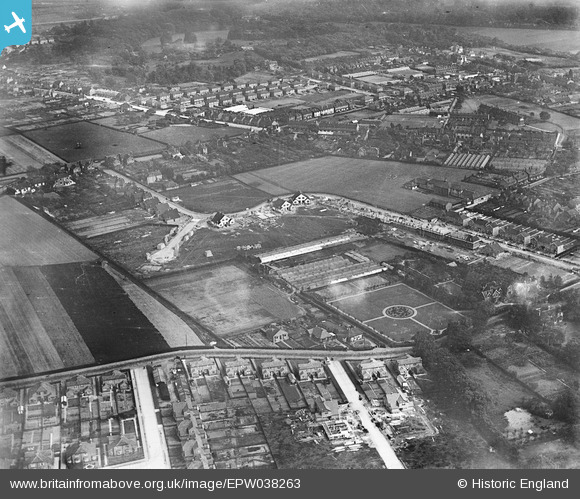
EPW038263 ENGLAND (1932). Construction of new housing at Pelham Road and environs, Bexleyheath, 1932
© Copyright OpenStreetMap contributors and licensed by the OpenStreetMap Foundation. 2026. Cartography is licensed as CC BY-SA.
Nearby Images (5)
EPW038263

EPW038264

EPW038268

EPW038267

EPW038262

Details
| Title | [EPW038263] Construction of new housing at Pelham Road and environs, Bexleyheath, 1932 |
| Reference | EPW038263 |
| Date | June-1932 |
| Link | |
| Place name | BEXLEYHEATH |
| Parish | |
| District | |
| Country | ENGLAND |
| Easting / Northing | 549432, 175687 |
| Longitude / Latitude | 0.15123652885056, 51.459918459021 |
| National Grid Reference | TQ494757 |
Pins

Barney |
Thursday 12th of January 2017 05:59:20 PM | |
|
Barney |
Thursday 12th of January 2017 05:45:54 PM | |
|
Barney |
Thursday 12th of January 2017 05:45:31 PM | |
|
Barney |
Thursday 12th of January 2017 05:45:03 PM | |
|
Barney |
Thursday 12th of January 2017 05:42:42 PM | |
|
Barney |
Thursday 12th of January 2017 05:42:16 PM | |
|
Barney |
Thursday 12th of January 2017 05:41:11 PM |