
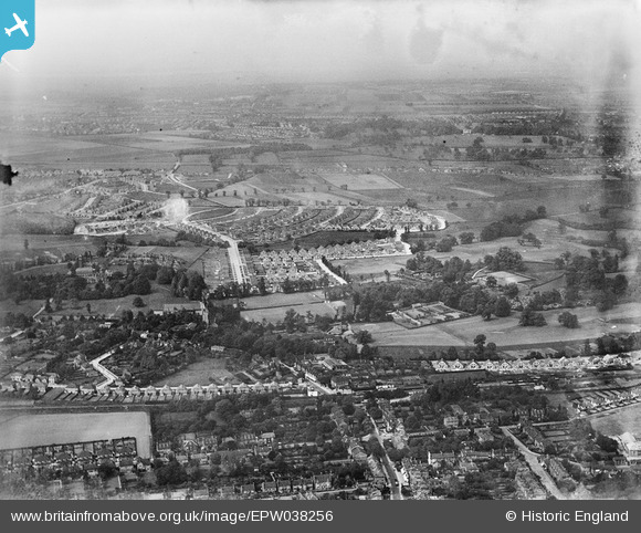
EPW038256 ENGLAND (1932). New housing around Marlborough Park and environs, Sidcup, from the south-east, 1932
© Copyright OpenStreetMap contributors and licensed by the OpenStreetMap Foundation. 2026. Cartography is licensed as CC BY-SA.
Nearby Images (4)
EPW038256

EPW038260

EPW038222

EPW044382

Details
| Title | [EPW038256] New housing around Marlborough Park and environs, Sidcup, from the south-east, 1932 |
| Reference | EPW038256 |
| Date | June-1932 |
| Link | |
| Place name | SIDCUP |
| Parish | |
| District | |
| Country | ENGLAND |
| Easting / Northing | 546345, 172994 |
| Longitude / Latitude | 0.10571445505416, 51.436524453463 |
| National Grid Reference | TQ463730 |
Pins

Barney |
Saturday 19th of May 2018 01:58:59 PM | |

David j |
Friday 14th of November 2014 09:58:32 PM | |
|
David j |
Friday 14th of November 2014 09:57:26 PM | |
|
chainbull |
Saturday 26th of July 2014 08:29:27 PM | |
|
chainbull |
Saturday 26th of July 2014 08:28:42 PM |