
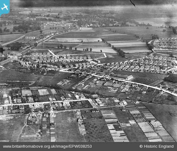
EPW038253 ENGLAND (1932). New housing at Days Lane and environs, Blackfen, from the north-west, 1932
© Copyright OpenStreetMap contributors and licensed by the OpenStreetMap Foundation. 2026. Cartography is licensed as CC BY-SA.
Nearby Images (6)
EPW038253

EPW038250

EPW038251

EPW038437

EPW038435

EPW038433

Details
| Title | [EPW038253] New housing at Days Lane and environs, Blackfen, from the north-west, 1932 |
| Reference | EPW038253 |
| Date | June-1932 |
| Link | |
| Place name | BLACKFEN |
| Parish | |
| District | |
| Country | ENGLAND |
| Easting / Northing | 545963, 174231 |
| Longitude / Latitude | 0.10073211789691, 51.447739377923 |
| National Grid Reference | TQ460742 |
Pins

FREDSDAD |
Tuesday 1st of November 2016 01:24:32 PM | |
|
FREDSDAD |
Tuesday 1st of November 2016 01:23:02 PM | |
|
FREDSDAD |
Tuesday 1st of November 2016 01:23:00 PM | |
|
PeterEm |
Sunday 27th of April 2014 02:38:10 PM | |
|
PeterEm |
Sunday 27th of April 2014 02:36:24 PM | |
|
PeterEm |
Sunday 27th of April 2014 02:33:31 PM | |
School hall in the middle of the long range. Fairly soon afterwards (I would guess) there was a second range added behind the first for the infants school, forming a quadrangle in the middle with the junior playground. Open veranda along the front with classrooms off. |
Tom Burnham |
Friday 23rd of May 2014 11:57:39 PM |
User Comment Contributions
Grew up in the bungalow at no17 Queenswood Road |
Mary L Marriott |
Friday 14th of August 2015 08:31:11 PM |