
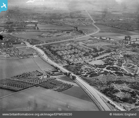
EPW038230 ENGLAND (1932). Shepherd's Lane and new housing at Heathview Crescent and environs, Dartford, 1932
© Copyright OpenStreetMap contributors and licensed by the OpenStreetMap Foundation. 2025. Cartography is licensed as CC BY-SA.
Nearby Images (4)
EPW038230

EPW038232

EPW038231

EPW038236

Details
| Title | [EPW038230] Shepherd's Lane and new housing at Heathview Crescent and environs, Dartford, 1932 |
| Reference | EPW038230 |
| Date | June-1932 |
| Link | |
| Place name | DARTFORD |
| Parish | |
| District | |
| Country | ENGLAND |
| Easting / Northing | 552501, 173489 |
| Longitude / Latitude | 0.19443612211436, 51.439348665289 |
| National Grid Reference | TQ525735 |
