
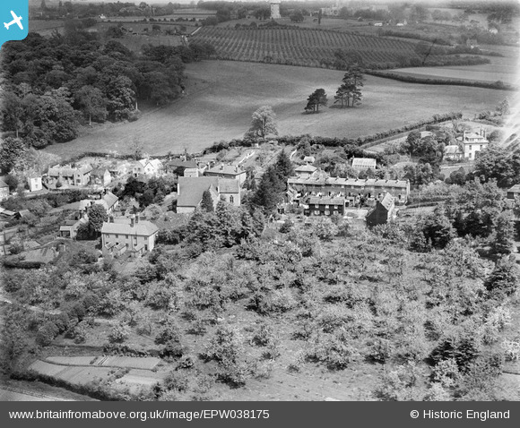
EPW038175 ENGLAND (1932). St Nicholas's Church, the village and surrounding countryside, Harbledown, 1932
© Copyright OpenStreetMap contributors and licensed by the OpenStreetMap Foundation. 2025. Cartography is licensed as CC BY-SA.
Nearby Images (2)
EPW038175

EPW038174

Details
| Title | [EPW038175] St Nicholas's Church, the village and surrounding countryside, Harbledown, 1932 |
| Reference | EPW038175 |
| Date | May-1932 |
| Link | |
| Place name | HARBLEDOWN |
| Parish | HARBLEDOWN AND ROUGH COMMON |
| District | |
| Country | ENGLAND |
| Easting / Northing | 613061, 158149 |
| Longitude / Latitude | 1.0555389671603, 51.282062053809 |
| National Grid Reference | TR131581 |
Pins
Be the first to add a comment to this image!