
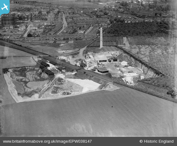
EPW038147 ENGLAND (1932). The Cooper Frank Lime Works, Canterbury, 1932
© Copyright OpenStreetMap contributors and licensed by the OpenStreetMap Foundation. 2025. Cartography is licensed as CC BY-SA.
Nearby Images (2)
EPW038147

EPW038148

Details
| Title | [EPW038147] The Cooper Frank Lime Works, Canterbury, 1932 |
| Reference | EPW038147 |
| Date | May-1932 |
| Link | |
| Place name | CANTERBURY |
| Parish | |
| District | |
| Country | ENGLAND |
| Easting / Northing | 614753, 156705 |
| Longitude / Latitude | 1.0788990665619, 51.2684598159 |
| National Grid Reference | TR148567 |
Pins

Mike |
Tuesday 25th of July 2023 12:12:06 AM | |
|
Mike |
Tuesday 25th of July 2023 12:10:45 AM | |
|
Mike |
Tuesday 25th of July 2023 12:09:45 AM | |
|
Mike |
Tuesday 25th of July 2023 12:04:48 AM | |
|
Mike |
Tuesday 25th of July 2023 12:03:28 AM |