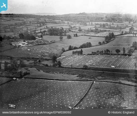
EPW038092 ENGLAND (1932). Whiteway's Cyder Orchards, Whimple, from the south-west, 1932
© Copyright OpenStreetMap contributors and licensed by the OpenStreetMap Foundation. 2025. Cartography is licensed as CC BY-SA.
Nearby Images (8)
Details
| Title | [EPW038092] Whiteway's Cyder Orchards, Whimple, from the south-west, 1932 |
| Reference | EPW038092 |
| Date | May-1932 |
| Link | |
| Place name | WHIMPLE |
| Parish | WHIMPLE |
| District | |
| Country | ENGLAND |
| Easting / Northing | 303910, 97170 |
| Longitude / Latitude | -3.3626983916283, 50.765583723888 |
| National Grid Reference | SY039972 |
Pins
Be the first to add a comment to this image!


![[EPW038092] Whiteway's Cyder Orchards, Whimple, from the south-west, 1932](http://britainfromabove.org.uk/sites/all/libraries/aerofilms-images/public/100x100/EPW/038/EPW038092.jpg)
![[EPW038093] Whiteway's Cyder Orchards, Whimple, from the south-west, 1932](http://britainfromabove.org.uk/sites/all/libraries/aerofilms-images/public/100x100/EPW/038/EPW038093.jpg)
![[EPW038094] Whiteway's Cyder Orchards, Whimple, from the south-west, 1932](http://britainfromabove.org.uk/sites/all/libraries/aerofilms-images/public/100x100/EPW/038/EPW038094.jpg)
![[EPW038085] Whiteway's Cyder Orchards, Whimple, 1932](http://britainfromabove.org.uk/sites/all/libraries/aerofilms-images/public/100x100/EPW/038/EPW038085.jpg)
![[EPW038083] Whiteway's Cyder Orchards with a crowd of people gathered on a hilltop, Whimple, 1932](http://britainfromabove.org.uk/sites/all/libraries/aerofilms-images/public/100x100/EPW/038/EPW038083.jpg)
![[EPW038081] Whiteway's Cyder Orchards with a crowd of people gathered on a hilltop, Whimple, 1932](http://britainfromabove.org.uk/sites/all/libraries/aerofilms-images/public/100x100/EPW/038/EPW038081.jpg)
![[EPW038091] Whiteway's Cyder Orchards with a crowd of people gathered on a hilltop, Whimple, 1932](http://britainfromabove.org.uk/sites/all/libraries/aerofilms-images/public/100x100/EPW/038/EPW038091.jpg)
![[EPW038073] Barnshayes and environs, Whimple, 1932](http://britainfromabove.org.uk/sites/all/libraries/aerofilms-images/public/100x100/EPW/038/EPW038073.jpg)