
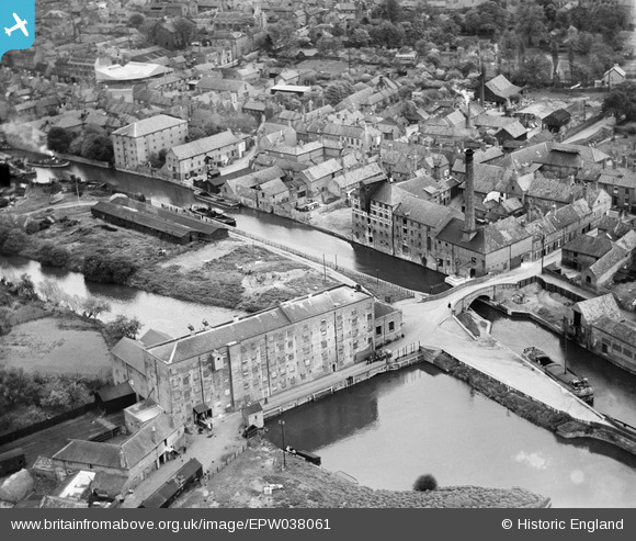
EPW038061 ENGLAND (1932). The Trent Navigation Company warehouse on Mill Lane and environs, Newark-on-Trent, 1932
© Copyright OpenStreetMap contributors and licensed by the OpenStreetMap Foundation. 2026. Cartography is licensed as CC BY-SA.
Nearby Images (5)
EPW038061

EPW038063

EPW038062

EPW016194

EAW016509

Details
| Title | [EPW038061] The Trent Navigation Company warehouse on Mill Lane and environs, Newark-on-Trent, 1932 |
| Reference | EPW038061 |
| Date | May-1932 |
| Link | |
| Place name | NEWARK-ON-TRENT |
| Parish | NEWARK |
| District | |
| Country | ENGLAND |
| Easting / Northing | 479368, 353740 |
| Longitude / Latitude | -0.81516832332844, 53.074686562428 |
| National Grid Reference | SK794537 |
Pins

MB |
Monday 7th of November 2016 09:58:13 AM |