
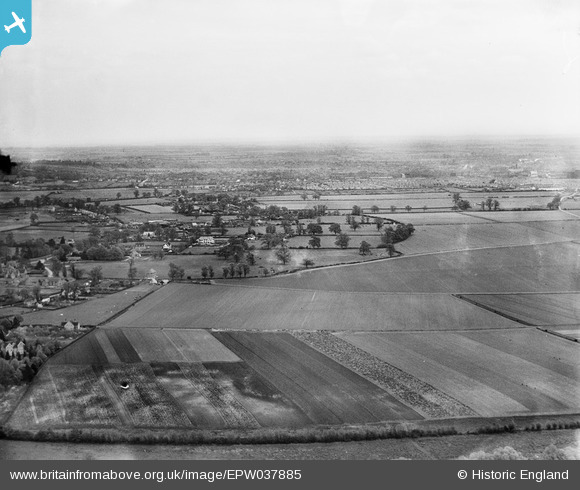
EPW037885 ENGLAND (1932). The village and surrounding countryside, Biddenham, from the south-west, 1932
© Copyright OpenStreetMap contributors and licensed by the OpenStreetMap Foundation. 2025. Cartography is licensed as CC BY-SA.
Nearby Images (3)
EPW037885

EPW037884

EPW037883

Details
| Title | [EPW037885] The village and surrounding countryside, Biddenham, from the south-west, 1932 |
| Reference | EPW037885 |
| Date | May-1932 |
| Link | |
| Place name | BIDDENHAM |
| Parish | GREAT DENHAM |
| District | |
| Country | ENGLAND |
| Easting / Northing | 501573, 249397 |
| Longitude / Latitude | -0.51584501232911, 52.133117845619 |
| National Grid Reference | TL016494 |
Pins

melgibbs |
Thursday 5th of December 2013 07:02:52 PM |